If You Look Closely At South Africa's Map, You’ll Find A Whole Country Hidden Inside It
If You Look Closely At South Africa's Map, You’ll Find A Whole Country Hidden Inside It Published By, Last Updated: July 15, 2026, 12:00 IST
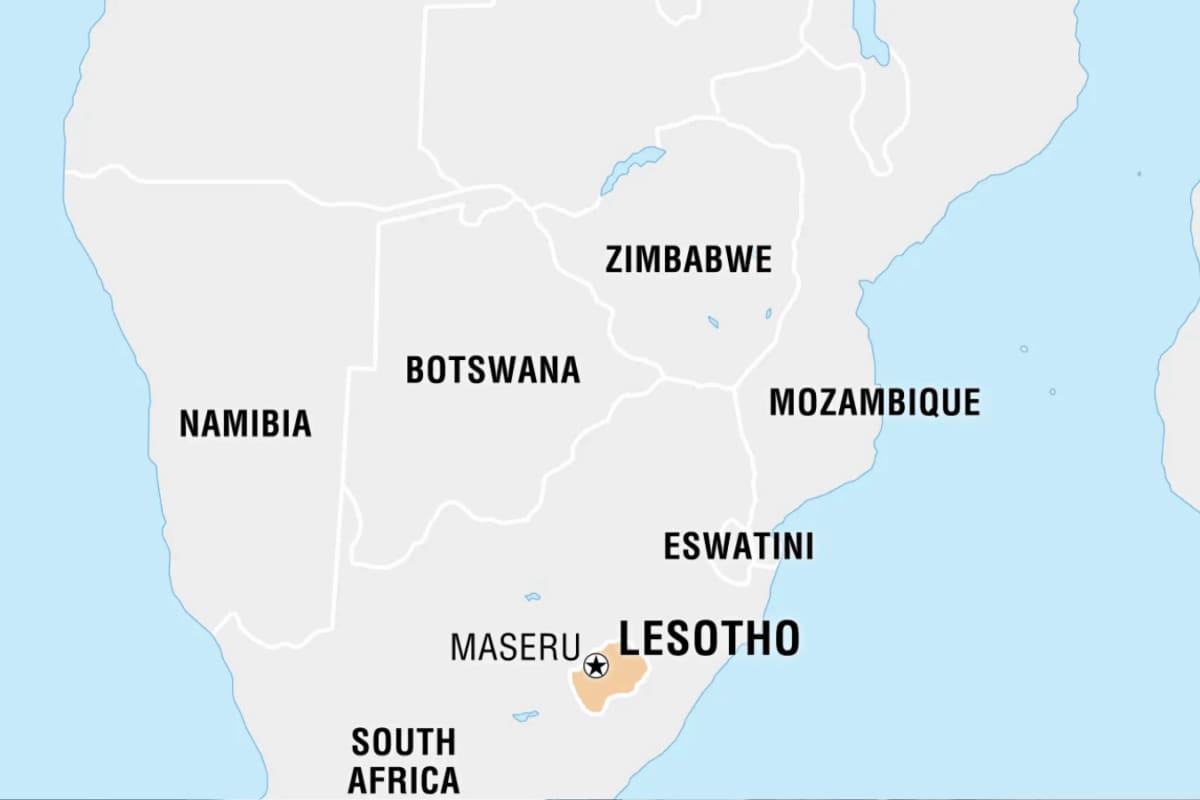
If You Look Closely At South Africa's Map, You’ll Find A Whole Country Hidden Inside It Published By, Last Updated: July 15, 2026, 12:00 IST The immediate question this map mystery raises is simple: How did a tiny nation keep itself from being swallowed up by a giant neighbor? Lesotho: A sovereign nation entirely encircled by South Africa. Source: Britannica Open up a world map and trace the borders of South Africa. Right in its eastern midsection, completely surrounded by South African territory, sits a giant, sovereign gap. This is Lesotho. It is not a state, a province or a colony. It is a fully independent nation with its own prime minister, flag, military and national passport. Known as a “country inside a country," Lesotho is one of only three “enclaved" nations on Earth (alongside Vatican City and San Marino). But unlike its tiny European counterparts, Lesotho is a massive, rugged mountain kingdom roughly the size of Belgium. The Natural Stone Fortress: How Lesotho Maintained Its Independence The immediate question this map mystery raises is simple: How did a tiny nation keep itself from being swallowed up by a giant neighbor?
The answer comes down to brilliant 19th-century military tactics and extreme terrain. When European colonial forces and warring tribes swept across southern Africa, the local Basotho people retreated deep into the jagged Drakensberg mountain range under the leadership of King Moshoeshoe I. These steep alpine heights acted as a natural stone fortress. Because invaders found it nearly impossible to wage war up the vertical, freezing cliffs, the kingdom successfully resisted annexation. When South Africa’s modern borders eventually took shape, this mountain kingdom held its ground, officially emerging as a completely independent state in 1966. What It is Actually Like Inside This Border Bubble Living as a geopolitical island shapes a completely distinct reality for the people of Lesotho 1. The Kingdom in the Sky Lesotho holds a rare global record: it is the only independent state on Earth where every single inch of territory sits at least 1,000 metres (3,281 feet) above sea level. Because more than 80% of the country rests above 1,800 metres, it is widely nicknamed the “Kingdom in the Sky." Read more: Karachi’s Secret: Did You Know This Megacity Of 20 Million Hides A 400-Year-Old ‘Car-Free’ Island?
2. Freezing Winters and African Snow Forget the common misconception that Africa is entirely sun-baked deserts and grassy savannas. Thanks to the extreme altitude, Lesotho experiences freezing winters and heavy snowfalls. It is one of the exceptionally rare places on the African continent featuring an active, commercial ski resort. 3. South Africa’s Water Tap While Lesotho relies entirely on South African roads, ports, and airspace to interact with the rest of the world, it holds an incredible strategic advantage: fresh water. The high mountain snowfalls feed massive engineering projects like the Katse Dam. Through these systems, Lesotho exports billions of gallons of pure water to South Africa’s dry industrial hubs, turning its unique geography into economic leverage. Travel Reality: Crossing The Enclave Entering Lesotho requires passing through formal international border control gates. The most famous route is the Sani Pass- a highly hairpinned, unpaved mountain track winding up from South Africa. At the absolute peak of this pass, travelers find Africa’s highest pub, where visitors can have a drink sitting right on the edge of the world’s most unique border bubble. News18 Newsletter Handpicked stories, in your inbox A newsletter with the best of our journalism submit Key Questions Answered How does Lesotho's unique geography impact its economy?
 The BriefWire