Wayanad landslides: How two villages vanished overnight
In the early hours of July 30, 2024, Chooralmala and Mundakkai villages in the district of Wayanad in Kerala were hit by devastating landslides triggered
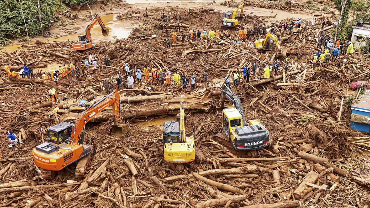
In the early hours of July 30, 2024, Chooralmala and Mundakkai villages in the district of Wayanad in Kerala were hit by devastating landslides triggered by torrential downpour. The massive landslides so far has claimed over 230 lives. According to the district administration, over 130 people are still missing as of August 13. This is the worst natural disaster to occur in Kerala since the 2018 floods. Chooralmala and Mundakkai, both located in Meppadi panchayat, are nearly 50 km away from the district headquarters in Kalpetta. They were known for its scenic landscapes and waterfalls. Mundakkai is just 2.3 km away from Chooralmala town by road. Following the incident, the authorities launched a massive rescue operation in the area to look for possible survivors. A combined rescue mission of the Indian Army, Disaster Response Force (NDRF), Fire and Rescue Services, Forest and Wildlife authorities, and the police, along with hundreds of volunteers and government officials rescued several stranded people in the surrounding forest area and mud-filled locations. On August 1, Chief Minister Pinarayi Vijayan said over 9,300 people were staying in 91 relief camps in Wayanad district. Now, the search has entered its final phase. A 190-member team comprising NDRF, the police, Fire and Rescue Services, the Civil Defence Force, the Forest department, and rescue volunteers is engaged in the search for missing people in five zones of the disaster-struck area. The search mission had to stop several times due to heavy rains in the last two weeks and also when Prime Minister Narendra Modi visited the villages on August 10, 2024.
Areas hit by the landslide The origin of the landslide has been identified as a valley above Punchirimattom, near the Mundakkai region. According to the satellite imagery released by ISRO’s Remote Sensing Centre (NRSC), the “crown of the landslide” or the origin is above 1,550m above Mean Sea Level (MSL) and the approximate size of the main scarp is 86,000 sq m — roughly equivalent to 12 football fields. The debri has traveled about 8 kilometers along the Iruvaniphuza river, altering its course, causing breaches in the banks, and destroying buildings and homes along the riverbanks. The images, captured by the Cartosat-3 and RISAT satellites, also show the before and after conditions of the affected areas. The pre-event images were taken by Cartosat-3 on May 22, 2023, while the post-event images were captured by the RISAT satellite on July 31, 2024. The pre-event image also shows an earlier landslide at the crown zone. Mundakkai and Punchirimattom areas The NRSC report reveals that torrential rains in the region triggered a massive debris flow, which intensified the landslide. The devastation was severe, with entire villages flattened. Chooralmala area The trigger The cause and various factors that have contributed to the intensity of the disaster are yet to be ascertained. However, the reports of post-disaster studies conducted by Kerala hold human-induced activities chiefly responsible for the increased intensity of landslides, although they point to excessive rains as the common trigger factor for the disaster. Since June 22, the area has been subjected to nearly continuous rainfall, with only short breaks.
 The BriefWire