Mumbai Receives Showers Amid Yellow Alert; Northeast, South Get Rain: Monsoon Finally Set To Arrive?
Mumbai Wakes Up To Showers; Northeast, South Get Rain: Monsoon Finally Set To Arrive? Published By, Last Updated: June 22, 2026, 11:59 IST The IMD
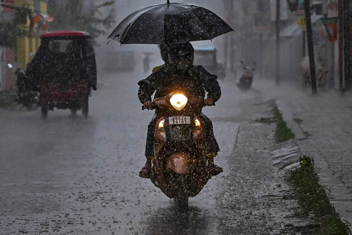
Mumbai Wakes Up To Showers; Northeast, South Get Rain: Monsoon Finally Set To Arrive? Published By, Last Updated: June 22, 2026, 11:59 IST The IMD said that conditions are favourable for the monsoon to advance significantly over Maharashtra, Telangana, Odisha, Jharkhand, Chhattisgarh and Bihar around June 23 Rapid Read Heavy rain lashes Nadia on Monday. (PTI) The Southwest Monsoon is actively gaining momentum across India, bringing widespread relief but presenting a highly split weather pattern — extreme rainfall is pounding Northeast India while pockets of Central India endure severe heatwaves. After a lengthy two-week delay blamed on atmospheric dry air and El Niño conditions, the India Meteorological Department (IMD) said that conditions are now highly favourable for the monsoon to advance significantly over Maharashtra, Telangana, Odisha, Jharkhand, Chhattisgarh, and Bihar around June 23. REGION-WISE WEATHER BREAKDOWN West India and Mumbai onset Mumbai and Konkan woke up to heavy, widespread monsoon showers after a prolonged stall. A Yellow Alert is active for Mumbai, Thane, Palghar, and Raigad for June 22 and 23. Thunderstorms, lightning, and gusty winds reaching 30–40 kmph have been predicted. Rains are desperately needed; local lakes have hit a critical low of 9% water capacity. Rain will intensify over Konkan and Goa into full-scale widespread downpours from June 23 to 27. #WATCH | Maharashtra | Rain lashes parts of Bandra EastMumbai and surrounding areas are witnessing pre-monsoon showers with lightning and thunderstorms. The monsoon onset in Mumbai is expected later today or tomorrow. The IMD will announce the monsoon only when all parameters… pic.twitter.com/Q7xL5sTYJh — ANI (@ANI) June 22, 2026 Northeast India & East India Extreme, relentless rain is pounding the region.
Mawsynram recorded 53 cm and Cherrapunji recorded 47 cm of rain in just 24 hours. Active landslide, flash flood, and rough sea warnings remain in effect across Assam, Meghalaya, and Arunachal Pradesh through June 25. Thundersqualls with winds of 50–60 kmph are hitting Jharkhand, Odisha, and Bihar. Isolated very heavy rain will lash Sub-Himalayan West Bengal and Sikkim. North & Central India Delhi-NCR is expecting light rain and thunderstorms with strong winds (40–60 kmph) between June 22 and 24, keeping maximum temperatures balanced between 35°C and 39°C. The official monsoon system is delayed over Delhi and Noida; current showers stem from Western Disturbances, not the monsoon pulse. Severe heatwaves continue in isolated pockets of Chhattisgarh, East Madhya Pradesh, Vidarbha, and East Uttar Pradesh. #WATCH | Maharashtra | Rain lashes parts of Mumbai; visuals from Eastern Express Highway.Mumbai and surrounding areas are witnessing pre-monsoon showers with lightning and thunderstorms. The monsoon onset in Mumbai is expected later today or tomorrow. The IMD will announce the… pic.twitter.com/0Dlxm3R8Bu — ANI (@ANI) June 22, 2026 South Peninsular India Active downpours are hitting Tamil Nadu, Kerala, Lakshadweep, and Coastal/Interior Karnataka. Telangana is expecting isolated heavy rain along with thunderstorms and lightning through the week. THE DELAY The 2026 Southwest Monsoon across India is facing a significant nationwide slowdown. After arriving in Kerala on June 4, three days later than the standard June 1 mark, the monsoon stream stalled heavily along the western coast. This has triggered a nationwide rainfall deficit of 41% as of late June. The delay is primarily driven by global El Niño conditions, a weak Somali jet stream, and a lack of active low-pressure systems over the Bay of Bengal.