El Nino has hit India: How agriculture shock is likely as farmers brace for impact
A patch of seawater in the middle of the Pacific Ocean, thousands of kilometres from any Indian coast, has just shifted the odds for every
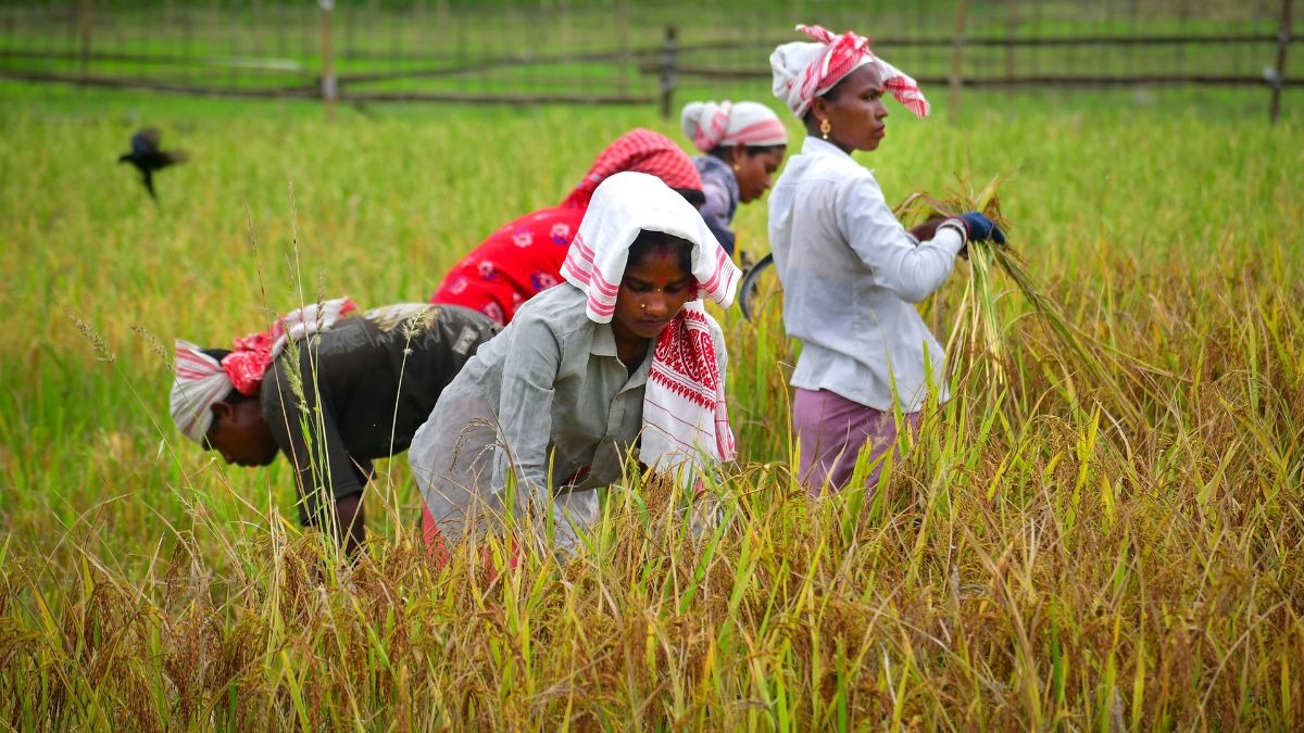
A patch of seawater in the middle of the Pacific Ocean, thousands of kilometres from any Indian coast, has just shifted the odds for every farmer in the country. On June 13, the India Meteorological Department (IMD) declared the onset of El Nino. In its June bulletin, the department said sea temperatures in the central Pacific had crossed the threshold that defines the phenomenon, and warned that it is likely to strengthen through the monsoon season. Read Full Story India has learnt to fear those two words. The IMD had already cut its forecast for the 2026 monsoon to 90 per cent of the Long Period Average, the benchmark for a normal season measured across the fifty years from 1971 to 2020. It now puts the chance of a deficient monsoon at 60 per cent. For a country where most farms still drink only when it rains, that is a warning, not a footnote.
WHAT EL NINO ACTUALLY IS El Nino is a periodic warming of the central and eastern Pacific Ocean. Scientists call it official once a stretch of that ocean stays more than half a degree Celsius warmer than normal for three months running, which is exactly what has now happened. In a normal year, steady winds called the trade winds blow from east to west along the equator, herding warm surface water towards Asia. That warm pool gathers near Indonesia, feeding the rising, moisture-laden air that eventually powers India's monsoon. Cooler water wells up in the east, off South America. This great east-west loop of air is the Walker Circulation. During El Nino, the trade winds tire. The warm water slides back east. The engine that drags moisture towards India loses its grip. WHY A WARM PACIFIC DRIES AN INDIAN FIELD When the warm water shifts east, the rising air shifts with it.
Over India, the opposite begins to happen. The air starts to sink. Meteorologists call this subsidence, which simply means descending air. Sinking air warms, dries, and refuses to build rain clouds. The monsoon winds weaken, carry less moisture, and the rain that does fall arrives unevenly. The IMD warns that the monsoon core zone, the rain-fed belt across central, western and eastern India where irrigation is thinnest, is likely to stay below normal. THE CROPS THAT FEEL IT FIRST Not every crop suffers equally. Pulses and oilseeds, grown largely without irrigation, are the most exposed. A dry spell at the wrong moment can shrink a whole harvest. Coarse cereals such as bajra and jowar have stumbled in past El Nino years too. El Nino has been declared, and India's farmers are bracing for a shock. The warming Pacific has weakened the monsoon before, and the IMD says it will likely strengthen as the rains advance.