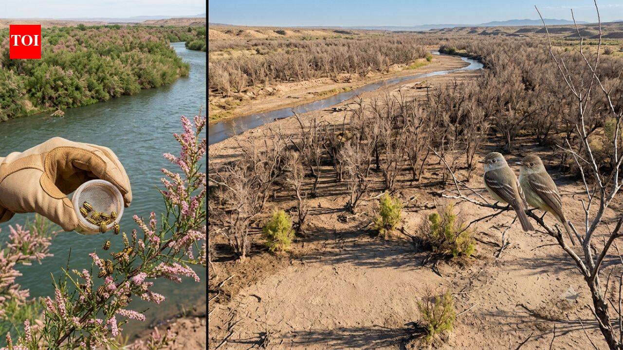
In 2001, scientists released beetles to fight an invasive tree. Years later, an endangered bird had lost 94% of its habitat along one western river
Southwestern Willow Flycatcher breeding habitat and conservation How satellite mapping tracks changes in flycatcher habitat An introduced beetle creates an unexpected conservation challenge in 2001
Southwestern Willow Flycatcher breeding habitat and conservation How satellite mapping tracks changes in flycatcher habitat An introduced beetle creates an unexpected conservation challenge in 2001 Why tamarisk matters to the flycatcher Helping conservation managers decide where to act A collaborative effort across federal agencies The breeding grounds of the Southwestern Willow Flycatcher stretch across thousands of kilometres of rivers and streams in the American Southwest, yet much of its habitat has long been difficult to assess in a consistent way. Thick vegetation, changing river systems and seasonal drought all make monitoring the small migratory bird a complex task. A report from the U.S. Geological Survey offers a broader picture than conservation agencies have had before, bringing together satellite observations to map suitable breeding habitat across the bird's entire range. The work provides land managers with a way to monitor habitat changes over time while also helping them identify areas where emerging threats could have the greatest effect on one of the United States' federally protected endangered bird species.The Southwestern Willow Flycatcher is a small songbird that depends on dense riverside vegetation for nesting during its breeding season, which generally runs from May until September. It occupies riparian corridors across parts of the southwestern United States, relying on healthy stands of shrubs and trees growing beside rivers and streams.Its conservation has been a long-standing priority under the Endangered Species Act.In 2013, the U.S. Fish and Wildlife Service identified nearly 1,975 stream kilometres of critical habitat spanning six states and 38 counties.
Protecting such an extensive and fragmented landscape has remained difficult because conditions can shift from one year to the next through drought, flooding, vegetation change and human activity.The USGS report attempts to bridge that gap by using satellite-based modelling to examine breeding habitat across the species' full distribution instead of relying only on local field surveys.Rather than focusing on individual nesting sites, the satellite model evaluates vegetation patterns over entire watersheds. That allows scientists to identify places likely to support breeding flycatchers and observe how those areas expand or contract over successive years.According to the report, yearly climate differences leave a clear mark on available habitat. During the severe drought years between 2013 and 2015, suitable habitat declined across parts of California. At the same time, conditions improved in portions of New Mexico and Texas, illustrating how regional weather patterns can reshape breeding opportunities across the bird's range.The approach also provides conservation agencies with a consistent way of comparing landscapes spread across several states, something that has previously been difficult using field observations alone.The report examines another issue affecting the species: the spread of the tamarisk leaf beetle.The insect was intentionally introduced in 2001 by the U.S. Department of Agriculture's Animal and Plant Health Inspection Service as a biological control for invasive tamarisk trees. Tamarisk, sometimes called saltcedar, had spread widely along rivers and streams throughout the western United States, displacing many native plants and altering river ecosystems.Since those original releases at ten locations across six western states, the beetle has expanded well beyond its initial range.
 The BriefWire