Why same monsoon rain that wets Delhi is set to turn deadly in hills this week
The same cloud can be a blessing over one city and a catastrophe a few hundred kilometres away. This week, as a monsoon depression drags
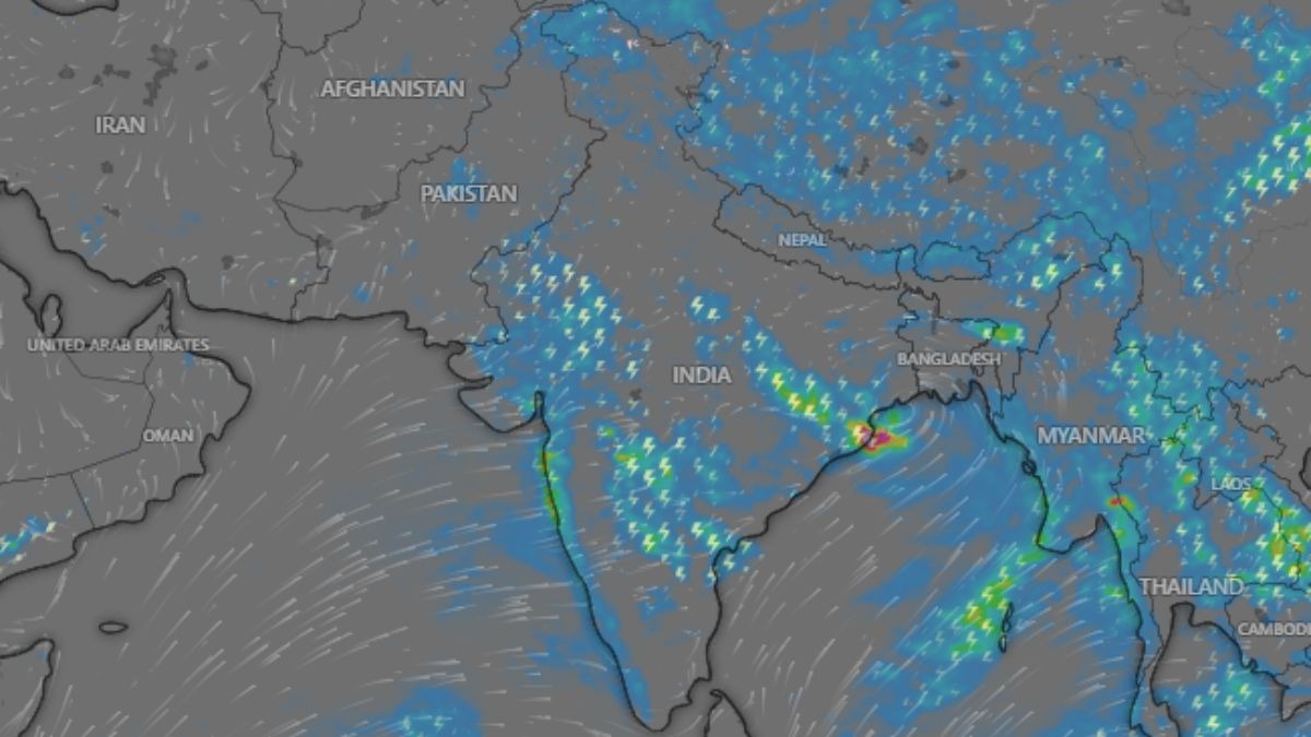
The same cloud can be a blessing over one city and a catastrophe a few hundred kilometres away. This week, as a monsoon depression drags the rains across northern India, Delhi will get a grey sky, a cooler afternoon and puddles on the road. Uttarakhand and Himachal Pradesh, fed by the very same moist wind, face something far more dangerous: the risk of cloudbursts, flash floods and hillsides giving way. The rain is the same. The land it falls on is not, and that difference is written in physics. Read Full Story WHY DOES THE SAME RAIN BEHAVE SO DIFFERENTLY IN THE HILLS? The answer is the shape of the ground. Over the flat plains of Delhi and Haryana, moist air drifts along and rains when it is ready, spreading its water gently over a wide area. But when that same air reaches the foothills of the Himalayas, it hits a wall it cannot go around. It is forced to climb. Orographic lifting forces moist air up mountain slopes, cooling it and squeezing out far more rain than the plains ever see. (Photo: PTI) This forced climb is called orographic lifting, and it is the single reason the hills are so much wetter than the plains. As air is pushed up a mountain slope, the pressure around it drops, so it expands and cools. Cooler air cannot hold as much moisture, so the water vapour condenses faster and falls harder.
The mountain does not just receive the rain. It actively wrings more of it out of the sky, like a hand squeezing a wet sponge. WHAT IS A CLOUDBURST, AND WHY DO HILLS INVITE THEM? Push that process to its extreme and you get a cloudburst. A cloudburst is a sudden, violent downpour, officially defined as more than 100 millimetres of rain in a single hour over a small area. That is a month of ordinary rain arriving in 60 minutes. Mountains make them more likely for a simple reason. The steep slopes keep shoving air upward long after it is already saturated, building towering storm clouds that stack water higher and higher until they collapse all at once over a narrow valley. A cloudburst dumps more than 100 millimetres of rain in an hour, a volume the steep, narrow valleys cannot drain away. (Photo: PTI) The terrain that lifts the air also traps it, concentrating an enormous volume of water onto a tiny patch of ground. On the plains, that same water would spread out and drain away. In the hills, it has nowhere to go but down the slope. WHY DO CLOUDBURSTS TURN INTO FLOODS AND LANDSLIDES SO FAST? Because in the mountains, water gathers speed and company. Rain that falls high on a slope does not soak in. It races downhill, collecting into narrow streams that swell in minutes, funnelling through valleys that act like chutes.
 The BriefWire